


Heinz might say they have 57 varieties.
But they don’t. Pure fiction.
The Re/Cap, on the other hand, does, having just published #57 last week in championing practically 57 varieties of innovation! It got Re/Cap HQ thinking; on account of the ‘Cap’s medley of interests, it may be high time for another ‘Best-Of,’ only this time dedicated to a specific tech.
And folks, it’s a doozy, so much so that you’ll probably want to LiDOWN for it.

Ahead is a curation, a sizzle reel as it were, of the past 14 months’ most transcendent scanning advancements. And Jimmy Carter, ice age bears, spacecraft, historic black schools, Oscar winners, steel recycling, the Silk Road, poop drones, and how to get a better seat on Broadway, are merely the tip of the lightberg.
So enjoy, in chronological order starting from the inaugural Re/Cap in March 2024 (we didn’t even edit a word of the nascent, experimental, wtf-are-we-doing writing!), the LiDAR all-timers.

Surveying and scanning a Rosenwald School in Newtown, Virginia. Image credit Dan Addison, UVA Communications.
University of Virginia alumni Jody Lahendro and Will Rourk share three fiery passions: architectural history, culture, and scanning Their current project? Surveying, scanning, and preserving a Rosenwald School for African Americans that was built in partnership with Booker T. Washington 113 years ago; all for people to experience it via virtual reality walkthrough. Read the remarkable full story with clouds of scanning talk, and profiles of the devoted team.
Antero Kukko, Research Professor at the Finnish Geospatial Research Institute, summarized his scanning excursion as “Millions of mosquitoes, quick fixes with buckets and cloths and emergency chocolate—it was a journey to remember.”
Looks like the 21st Century has its Ernest Shackleton!

Professor Antero Kukko and his backpack LiDAR system on Canada’s Axel Heiberg island. To say it’s north is like saying Death Valley gets warm. Image credit American Surveyor
For a journey five years in the making, it lived up the hype, not to mention pure North Canadian/Inuit serenity. Subsequent to the goals of erosion evaluation and “sediment transport in an event of a glacial lake outburst,” findings will be published in Nature Communications.
Read the full account below, rich with history, LiDAR, and & hydrology, as featured in American Surveyor.
Salt Lake City’s Kindig it Design boasts a quarter century of immaculate auto restoration & customization. With its hit TV show Bitchin’ Rides, it also can claim a decade of television dominance on Motor Trend. And much of it is owed to owner Dave Kindig’s obsession with 3D laser scanners.

Old cars. New tech. Staggering beauty. Image credit Develop3D
A FARO fanatic, Dave teamed up with the scanning behemoth for an illuminating case study, “Pedal to the 3D Printed Metal: How Laser Measurement is Transforming the Automotive Industry.”
Regardless of whether you’re a gearhead, it’s a stellar profile, and the scanner talk is in overdrive.
Believed to have been erected in 460 A.D., the Swayambhunath Temple is among the holiest Buddhist stupas in Nepal. And to a small team of American reality capturers, it might now be the most personal.

“Cool lasers. Hey, rate my banana consumption workflow?” Image credit &Beyond
Helmed by a professor and research scientist at The University of North Carolina at Chapel Hill, the team has employed 3D laser scans, photogrammetry and drone photography to capture the venerated temple. The biggest obstacle for this project backed by Lenovo and NVIDIA? Crowds and monkeys. If a reality capture obstacle course-based TV show ever gets greenlit, we might just have our first challenge!
Carmina, the hand-crafted shoemaker founded in 1866, is embracing the technology of 2066.

And you thought a pedi felt like VIP treatment! Image credit YouTube
Popular men’s lifestyle influencer Kirby Allison confirmed it, as he forewent the tape measurer and brannock device for a scanned, fully customized shoe last. Now let’s just see him wear the final product on a concrete job.
Every year, utility strikes kill hundreds, injure thousands, and cost billions. So one tenacious New Zealand company is getting to the bottom of it. Literally.

What lies beneath? Reveal easily reveals. Image credit Reveal
Reveal is transforming infrastructure Down Under, swiftly capturing as-built data from exposed utilities, chamber interiors, and surface models of the road corridor. It’s due in large part to the intrepid vision of CTO Tim Rastall, which entails no shovel or bucket ever touching a main again.
Enjoy his expansive interview with Roads & Infrastructure Australia below.
Oregon’s Silver Falls State Park is much more than foliage, creeks and newts; it’s a time capsule, home to three structures built by the Depression-era’s Civilian Conservation Corps as part of the New Deal. And unlike most other preservation projects, their biggest threat isn’t decay.
It’s fire.

The South Falls Lodge, fixin’ to get CAPTURED. Image credit Blake Brown.
The Pacific Northwest has been no stranger to summer blazes, and projections show it will only be more susceptible with time. So researchers at Oregon State University are putting technology to use, ensuring local history won’t fade into obscurity.
Even if at a slower rate, the global population is still growing.
Our food production and management skills are not.

A watched pot may never boil, but an unwatched crop may never yield! Image credit APO Geospatial
It’s a problem, but one for which a project out of the UK's Aston University may have the solution.
Funding from the UK Royal Society will advance polarimetric LiDAR, the focal point of Sergey Sergeyev’s lab at Aston Institute of Photonic Technologies. The ambition? Novel remote sensing approaches toward information & communication technology in farming for increased food production. Yum.
Yes, it’s actually pronounced “Jeh-dye”, yes it’s a device that shoots laser beams from the bloody International Space Station, and yes, we now hold precious data on the Amazon, the Andes, and Patagonia.
And ain’t nothin’ science-fiction about it.

The best Jedi Mind Trick GEDI might pull is doing the coolest of things despite looking like a mini-fridge from 1958, but whatevs. Image credit ScienceFriday
The Global Ecosystem Dynamics Investigation has just been extended by NASA, meaning for at least six more years, this laser blazin’ cosmic canopy capturer can keep getting researchers the stored carbon data of millions of trees. How exactly? Let ScienceFriday tell ya, along with bonus abilities GERD possesses as it shines a light on the dark side of natural disasters.
“Ruins are reflections of a perfect whole that once existed,” Calvin University’s Archaeology Director Darrell Rohl elucidates for us.
And thanks to a Fulbright scholarship, he’s got a dream set of ruins. And whereas current archeological drawings seldom showcase 1-meter resolution, Rohl’s elated to live in the 15-mm domain.

Who needs Air Jordan when you can scan Rare Jordan? Image credit Universe in Universes
This September, he will commence ten months of laser scanning Umm el-Jimal, a Jordanian village that originated in the first century A.D. under the Nabatean people. Read about the history, the technology, and the varied ambitions of the project that can serve students, professionals, and society alike.
On the whole, 2023’s Napoleon did not garner the same praise as director Ridley Scott’s signature flicks (Alien, Gladiator, Black Hawk Down, Blade Runner).
But its visual effects sure did.

Real actors, horses, smoke, powdered wigs - all to be scanned and utilized elsewhere. Image credit befores & afters
They earned the biopic an Academy Award for Best Visual Effects, thanks to the slick, 1,000,000-image based reality capture of Visualskies. It actually prompted confusion, as viewers weren’t sure when and where visual effects were even used. Tip thine cap to LiDAR and photogrammetry, which have proven far more convincing than average CGI. Befores & Afters has the full story available as an excerpt of their magazine issue, packed with keen insight from Duncan Lees, Visualskies’ Director of LiDAR.
Alabama’s Edmund Pettus Bridge was the site of 1965’s ”Bloody Sunday,” during which 600 Selma-to-Montgomery marchers were viciously attacked by state troopers. So as an iconic symbol of America’s civil rights movement - one with a unique construction methodology to boot - three capturers knew this vital bridge had to be documented.

The calm before the storm that would be Bloody Sunday, an indelible moment in America’s history. Image credit Workers World
Danielle Willkens, Junshan Liu, and Shadi Alathamneh harnessed terrestrial scanners, 360° cameras, UAVs, structure from motion, BIM, and more to honor the Southern landmark. Get the case study’s abstract below, where you'll also find a download option for the exceptional full paper if desired.
Spartan Scanning Solutions Founder & President Anthony Butchbaker knows that a good way to change the world is to start by changing one thing. And he wants that “lighthouse for change” to be steel, and specifically, its recycling.
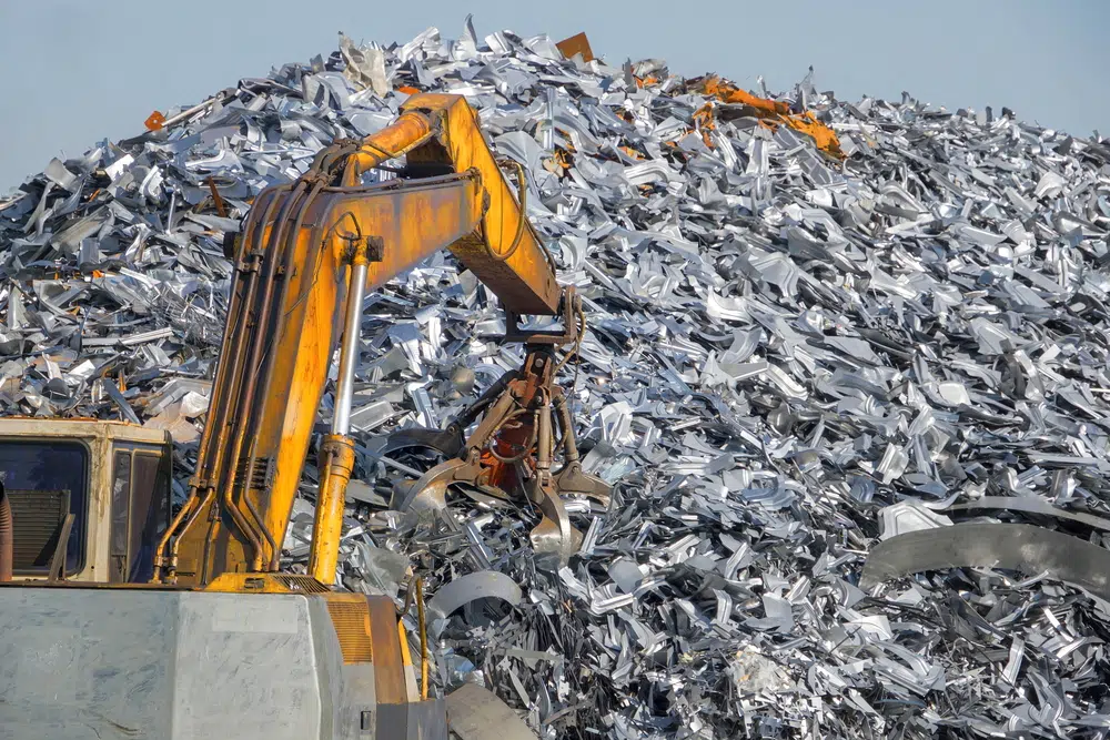
Exhibit A of what people in 2300 will probably facepalm over. Image credit Service Steel Warehouse
His passion, knowledge, and roadmap were irresistible for Recycling Today, which corralled him for an expansive interview. Framed around use cases for steel mills and auto shredders, it explores Spartan’s four prime objectives, geo-referencing, modules, energy savings, and much more.
In between their astonishing architectural feats, calendar development, and occasional human sacrifices, The Maya loved games; ball courts were nearly ubiquitous in prominent Maya sites, making a recent discovery ooze intrigue.

Word has it that if you were attending juego de pelota (ball game), you could either buy popcorn or sacrifice someone for it. Image credit Smithsonian
A survey and excavation of a Maya ball court in the Mexican state of Campeche has unearthed a puzzling structure. Likely dating back to 200-600 AD, the structure’s walls featured abundant remains of painted stucco. Additionally, nearby was some type of ceremonial center with walls 40 feet in height. The hypothesizing has only just begun on this revelation, but Smithsonian Magazine is on the case. Take their latest Maya tour below.
We know that, according to the NHTSA, the U.S. alone sees approximately 15,000 annual bridge impacts from trucks.
We also know that due to a recent government initiative, New South Wales has had it, well, up to here with them.

Spoiler alert - she did not turn. Image credit TheDrive
And why wouldn’t they, given the massive time and resource costs that accompany frequent overheight incidents? After a trial involving four separate bodies, the NSW government will combine LiDAR captures of trucks with Automatic Number Plate Recognition (ANPR) software to give drivers real-time height data. Click below for a small story with potentially towering implications.
A pillar of how rotten the ticket industry has become is…pillars! Literally, as in finding one blocking your view as you take your seat.
London-based company Preevue, however, might be taking a technological wrecking ball to “view obstruction” at events; and Broadway is the worksite.

Scantom of the Opera. ★★★★. Image credit Preevue
Preevue has scanned nearly 70,000 seats in over 250 theaters worldwide, so they’ve got the reps down. And now, negotiations are underway with a prolific Broadway theater to revolutionize seat selection and transparency, as Forbes lays out in full below.
The Sistine Chapel is awe-inspiring, one of those feats that feels like its creator (Michelangelo) got a software upgrade to which the rest of us weren’t entitled.
However, its popularity has eroded one feature that “The Sistine Chapel of the North” in Naarden, Netherlands, has in spades - mystery, specifically within its murals.

The “barrel vault” of Grote Kerk Church in Naarden, Netherlands. Image credit Factum Foundation
But researchers from an assortment of Dutch universities have set out for some scanning solving. By revealing intricate details from brushwork to pigment the naked eye can’t register, the hope - on top of preservation - is that the grandest mystery of all is solved; who created this divine display, and when?
There is a type of disarray, if not mayhem, first responders face when confronting severe building damage and collapses. Just take room assessment, which is puzzling at best, dangerous and wasteful (repeat searches and assessments are common) at worst.
But researchers at Carnegie Mellon University's Robotics Institute may have wired up quite the robotic remedy.

UCMRI’s new toy processing geometric properties, and hopefully not soon concussing an unknowing custodian. Image credit Carnegie Mellon University
They’ve concocted a new LiDAR-based method for autonomous aerial robot exploration and multirobot coordination, in which door detection is profoundly easier (it’s more probable that humans would be in a room than a hallway in a disaster.) Click below for the point cloud process, why LiDAR was chosen over cameras, what the heck saddle points do, how these robots communicate, and much more wondrously neat stuff.
Even if the technology firefighters actually put their hands on has improved over the decades (the extent to which is debatable,) one technology realm they rely on for their heroism has not; evacuation routes.
This ossification means that determining their quickest path is an educated guess, drawn from a combination of experience, shared wisdom, and any surface knowledge they’ve gleaned.
Well, thanks to some University of Utah researchers, firefighters, disaster responders, rural health care workers, and others will get to hit their stride like never before.
No, literally, this routing revolution is called STRIDE.

A hiker rescue simulation of STRIDE route optimization. Image credit Scientific Reports via Phys.org
The “Simulating Travel Rates in Diverse Environments” is a first-of-its-kind, airborne LiDAR-based model that accounts for vegetation density, ground roughness, slope, and other nuanced factors. STRIDE will grant the aforementioned saviors paths of optimized travel, saving time, resources, and lives. Take a hike with Phys.org by clicking below, or you can put the lab coat on for the full scientific study published on Nature.com.
Today, only 3% of humans live at or above an elevation of 6,562 feet, which is where an extraordinary discovery was just made thanks to aerial LiDAR: two Silk Road strongholds, lost for centuries, nestled in the mountains of Uzbekistan.

‘Twas LiDAR and UAVs that led archaeologists to Tugunbulak, one of the ancient cities discovered. Image credit Michael Frachetti via CNN Science
Overseeing the project is Michael Frachetti, a professor of archaeology at the Spatial Analysis, Interpretation and Exploration laboratory at Washington University in St. Louis. Discovering hints of settlements, watchtowers, fortresses, and plazas, the operation is entering the excavation phase quicker than you can say “haggle.”
And the crew is not there to just collect some wares for a shot at Antiques Roadshow, oh no. They’re after who founded these mysterious cities, and why. CNN Science ran with the gripping story linked below, but you can also get academic and take in the paper proper, hosted on Nature.
LiDAR may be years into catapulting numerous industries into the future, but in physical security, it’s actually been relatively stagnant and elementary; largely 2D, and largely relegated to what’s essentially glorified fencing, albeit of a laser-based origin.
Smart LiDAR sensors, well, they’re sending security to get its doctorate. And market projections prove it, with estimates hovering around $6 billion by 2030.

Volumetric detection is en route to mass adoption thanks to LiDAR. Image credit JAGA Systems
The new 3D augmentations are “volumetric detection systems.” These enable detailed, whole-area observation, rather than mere boundary monitoring and its requisite finger crossing that the burglars have a lower IQ than those that messed with the wrong Macaulay Culkin.
Get the full scan below that covers, among other topics, labor intensiveness, regulatory compliance & personal identification quandaries, video management, and 3D surveillance software.
Last October, we Re/Capped a story on the preservation of Jimmy Carter’s virtuosic woodwork. Today, we’re honored to Re/Cap the digital preservation of his Depression-era youth, and the man it manifested.
We can thank the ingenuity of a research team at The University of South Florida’s Center for Digital Heritage and Geospatial Information, in tandem with the National Park Service. They’ve created stunning virtual tours of the preeminent peanut farmer’s boyhood home, high school, and campaign headquarters, capturing intricate details of the sites and 25 furniture pieces he personally crafted.

The home and farm of a future U.S. president. Image credit Lori Collins/University of South Florida
The project forms digital twins of historic spaces with sub-millimetric precision, making these locations accessible to people worldwide. It’s a feat which not only preserves consequential physical spaces, but also tells a poignant origin story of Carter's multifaceted life as a politician, humanitarian, woodworker, and community leader. A glimpse of the tour, within the exhaustive project overview, can be enjoyed below.
The cave bear, after an indomitable run in Europe and Asia devouring whatever moved and rummaging through whatever constituted prehistoric trash bins, went extinct around 28,000 years ago during the Last Glacial Maximum.
But thanks to reality capture heating up, we just got some maximum fossil data in Spain.

Reconstruction of the cave bear. Yeah, sure, lol, play dead, go for it. Image credit Sergio de la Larosa / CC BY-SA 3.0
A legion of scanners and photogrammetrists from Centro Nacional de Investigación sobre la Evolución Humana (CENIEH) uncovered 16 cave bear footprints in Honseca Cave, Palencia. It is the first record of Ursichnus europaeus in the Iberian Peninsula. Sci News covers the tracks with a den of quotes, modeling workflows, species history, and why fossils matter (hint - mindless hikers!) below, or bear all with the proper study here.
There’s a NASA & friends Jet Propulsion Laboratory, and it's propelling a lot more than spacecraft.
Or actually, a lot less - as in massless.Lacking mass is the defining quality of photons, the building blocks of light and in turn, LiDAR. And JPL’s tool just made detection & ranging more accurate than a clairvoyant sports bettor.

Depth and intensity measurement…from 45 meters away with a per-pixel acquisition time of 1 ms. Image credit Aongus McCarthy via Optica
It goes by SNSPD, but at parties it introduces itself as superconducting nanowire single-photon detector. Harnessed by 15 researchers from the UK’s Heriot-Watt University, it has crafted a bewildering accurate LiDAR system. We’re talking a system timing resolution 10x better than similar LiDAR systems, and clear 3D imaging of a human face from up to half a mile away.
The operative word is “clear,” as the system also makes quick work of smoke, fog, debris, foliage, you name it; music to the ears of security, monitoring, and remote sensing enthusiasts.
Linked below is Interesting Engineering’s laser focus on the single-photon time-of-flight tech, eye safety and spatial resolution improvements, the plethora of use cases, and what the next test entails, all linked below. Additionally, get graduate-level and enjoy the proper study as published on Optica.
Sadly, if you’ve seen how a moth is drawn to light, you’ve seen a metaphor for how catastrophic hydro-meteorological events are drawn to Africa. Increasingly, floods and droughts end lives, fracture livelihoods, and stifle economic development. Africa's vulnerability is exacerbated by rapid urbanization, and a lagging enforcement of building standards. But there’s a path to resilience being laid almost daily for city planners, with drone LiDAR doing the heavy lifting.

Flooding alone is responsible for the displacement of millions of Africans. Image credit Action Against Hunger
A prime example is the generation of flood risk maps, godsends for city planners’ efforts to designate the riskiest areas, and in turn design optimal drainage systems. Additionally, there’s seeing the forest for its trees, as some mega-reforestation is underway in Cape Town, courtesy of some shrewd drone work.
That’s not even half the payload of sUAS News’ recent story on Africa combating natural disasters through a tempest of tech. Click below for further data on urbanization, project time reduction rates, topo mapping & flood behavior, Tanzanian priorities, and community engagement.
Missouri is known as the Show Me state.
It might have to rebrand as the Save Me state, on account of how innovation is protecting pedestrians, sharpening driver awareness, reducing accidents, and illuminating behavior in and around work zones.

Don’t images like this really make the notion of texting while driving frightening? Image credit Ouster
It’s from the work of engineering researchers at the University of Missouri, anchored by Associate Professor Yaw Adu-Gyamfi and graduate student Linlin Zhang. Their LiDAR & AI-based method is a new way to interpret how pedestrians, cyclists, and vehicles interact, with particular focus at stoplights and work zones. It couldn’t be at a more opportune time, with self-driving cars possibly seeing a supernova of adoption.
UMizzou has got all the exciting deets below, including work with manufacturers, speed and distance measurements, cellular vehicle-to-everything (C-V2X), green light timing, IDing pavement problems, point cloud completion, algorithm building, and a whole glove box more.
Wind energy is a solid…hedge. Its turbines can go where solar panels can’t, and can produce on cloudy days when the sun’s rays take a raincheck. It evades the danger stigma of nuclear. And hydrogen, well…it’s like the MySpace of clean energy; big promise, a few early fans, but a lotta silence.
Unfortunately, though, there’s one massive wind energy downside that has experts racking their brains - effects on life under water, and birds above it. And while progress is being made on the former, a partnership for the latter is spreading the wings of avian safety, environmental monitoring, and renewable energy.

Fugro’s SEAWATCH wind LiDAR buoy. Image credit Fugro via Tomorrow’s World Today
The futuristic flock consists of Geo-data dynamos Fugro, and intelligent biodiversity monitoring maestros Spoor. Their stated goals include “helping renewable energy projects reduce environmental impact, develop a new AI bird monitoring system for offshore renewable energy projects, and make environmental assessments more affordable, cleaner, and safer.”
The hero in this story is Fugro’s SEAWATCH Wind LiDAR Buoys, which record bird activity on wind farms. Spoor’s computer vision and AI software then take the reins for species and activity analysis. It’s a tidal wave of efficiency, disposing of the burdens within traditional methods of offshore bird monitoring and legally-mandated environmental assessments: costly aircraft & vessel requirements, high carbon footprint, and storms that would have Lieutenant Dan screaming from a mast.
Tomorrow’s World Today covers the wind win below, including test sites, biodiversity requirements, the buoy-mounted cameras, and more.
Fraser, Michigan didn’t deserve coal for 2016’s Christmas, but it sure got some. $75 million of it to be precise, after a December 24, 11-foot diameter sewer debacle 70 feet deep. A literal sinkhole of expense.
Though far from a rarity, its magnitude and price tag instantiated inspection importance far and wide, which can detect the ever-common cracks that can lead to pipe collapse. But traditional methods for our aging sewersphere (tethered cameras or in-person checks) are slow, expensive, and dangerous in such dark and confined spaces.
Y’know, the very environments specialized drones can thrive in - and are - in Fraser’s Macomb County and beyond.

Flyability’s Elios 3, a popular sewer drone. Number 1 or 2 for sure. Image credit Flyability
Rocking LiDAR, 4K cameras, gas sensors and ultrasonic thickness gauges, Fraser’s drone fleet is literally winning awards for its payloads & AI-driven inspection prowess, as relayed by Wired magazine.
Proving that the future of sewer maintenance is autonomous, fast, and disaster-proof, it navigates pipes to capture pristine data while avoiding human entry. Then, ultimate cut-the-crap software program SewerAI analyzes footage to automatically detect defects, slashing inspection time from months to 24 hours and reducing costs by 90% (e.g., $100k vs. $1M every 3 years).
Inspections now cover 900 meters per day (vs. 400m manually) with 40% cost savings, while capturing not only video but LiDAR, infrared scans, and gas readings. AI catches defects humans often miss, prioritizing critical repairs to prevent sinkholes. Inspect Wired’s link below for additional chronicling of Macomb County’s initiatives, drone manufacturers, pilot profiles and tactics, more figures & data, and the inspection steps.
Big dunes? The ones in nature programming, the Wright Brothers’ Kitty Hawk, every third truck ad, your shoe after a 2-minute beach stroll, or, well, Dune?
We know how they form (a practical ocean of sand combined with abundant wind). Where things get mysterious is where they get granular, because small dunes, called “proto dunes,” are a Sahara-sized puzzle. They’re often tiny with a fleeting lifespan, making proper study harder than maintaining a sand castle in a tsunami.
But those obstacles are no more, thanks to the deft laser scanning and modeling of the University of Southampton and French research institutes.

In this line o’ work, TLS is “totally loving sand.” Image credit University of Southampton via Phys.org
The research team got scanning in Namibia, discovering that sand grains moving over firm, more dense surfaces bounce higher, becoming more sensitive to the wind. When these grains land on softer, rippled surfaces, they accumulate, leading to dune formation. As these initial bumps form, they alter wind patterns, promoting further sand accumulation and dune growth.
To deepen their understanding, the team crafted a computer model simulating these dynamics, and enabling parameter experimentation. It accurately replicated observations in myriad conditions, from arid regions like Namibia to moist climates like Colorado.
So there’s your Earthly geomorphology lesson and discovery for the day. The rest of the epiphany, though, has potential ramifications for Martian lessons and discovery, given the Red Planet’s sandy, windy makeup. Phys.org unveils the full study and takeaway below.


By subscribing, you are agreeing to RCN’s Terms and Conditions of Use. To learn how RCN collects, uses, shares, and protects your personal data, please see RCN’s Privacy Policy.
Reality Capture Network • Copyright 2025 • All rights reserved


