


Honor Teddy Roosevelt and splurge for that lifetime pass Re/Cappers, we’re off to a national park today for a lead story on LiDAR for smarts, safety, and upkept serenity.
Rock is the core of it; just like it was in the formative national park LiDAR operation, 16 years ago. Folks, that’s when the world met Walter White.
In the arid heart of central New Mexico, where the ruins of ancient pueblos and 17th-century Spanish missions rise from the earth, a quiet technological revolution of 3D scans & GIS unfolded at Salinas Pueblo Missions National Monument. Tasked with safeguarding the fragile remnants of the Abó Mission Complex and the enigmatic Abó Painted Rocks, the National Park Service turned to an innovative solution: something called “terrestrial LiDAR scanning.”
The most concerning obstacle at the onset was documenting the Painted Rocks and mission ruins in a way that avoided any disturbance to the fragile structures and rock art, a challenge that LiDAR proved uniquely suited to overcome due to its non-contact nature. HDR | e²M, entrusted with this mission, brought state-of-the-art goods to the site to capture every nuance of the weathered stone and intricate petroglyphs.
The process was both scrupulous and awe-inspiring. Using a Konica Minolta high-speed terrestrial scanner for the Painted Rocks area, the team collected millions of geo-referenced data points with astonishing precision. Each scan recorded the contours of walls and carvings, but also the subtle interplay of light and color, producing ultra-high-density point clouds imbued with both intensity and RGB values. High-def photographs were also taken to enhance the visualization of the rock surfaces, and integrate photographic detail with the point cloud models.
The data, processed through Applied Imagery’s Quick Terrain Modeler, revealed a digital landscape as vivid and detailed as the physical one - a perfect echo of history, preserved in three dimensions. And considering how formidable of an opponent data interoperability was, the relief was surely sweet. For the first time, conservators and archaeologists could study the missions and rock art in unprecedented detail, monitor their slow transformation under the relentless New Mexican sun, and plan restoration efforts with scientific accuracy.
The LiDAR scanning at Salinas was part of a broader, multi-year effort to document the pictographs, paintings, and cultural significance at the Abó Painted Rocks site, spanning from 2008 to 2010. Beyond preservation, the data produced contributed to regional education and interpretive efforts, strengthening cultural connections with surrounding Hispanic and Pueblo communities whose ancestry is tied to the monument.
And it’s still, going! Just two months ago, a closure occurred so staff could capture the Church, Convento and sections of the interpretive trail to ensure structurally vulnerable areas will remain tip-top. Even photogrammetry has joined the 2025 party.
What a wonder. The project’s meticulous and non-invasive digital documentation set a new standard for heritage management and preservation within the NPS. LiDAR scans and 3D GIS demonstrated how pioneering tech could serve stewardship, capturing the spirit and substance of irreplaceable sites for generations to come. In doing so, it inspired a wave of digital preservation efforts across America’s national parks and monuments, forever changing how we protect our collective past.
And as we’ll get to shortly, even protect our roads, and the drivers on them.
So good job, New Mexico. Breaking Bad, and Scanning Well, in the same bloody year.
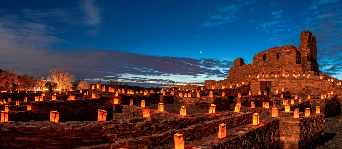
A place that lights its own past, well after lighting our preservation future. Image credit National Park Service
What’s Cappenin’ This Week
Quick ‘Caps
Danger: falling rocks has never looked so beautiful.
One of the best parts of Utah’s Bryce Canyon National Park is, well…entering it. The signature “Red Canyon Arches” were crowned a century ago as the welcome to (then) Utah National Park, and they’ve since become iconic.
But for stone, with a century’s tenure often comes erosion. That means the occasional rock succumbing to gravity and leaving its mark on either your ride, or Utah State Route 12.
But now, thanks to some nifty Utah Department of Transportation LiDAR, the arches will remain much more intact - and so will your windshield.
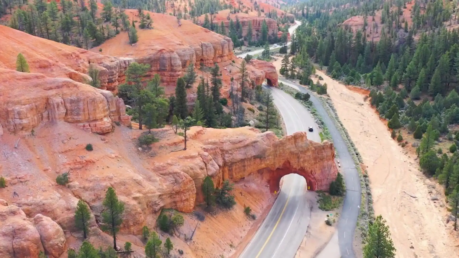
The Red Canyon Arches of Bryce Canyon National Park. They’re like welcome mats only stone and vertical. Image credit Utah Department of Transportation via Unofficial Networks
Now in phase two of a six-year maintenance project, newly secured funding means newly added drones, sensors, and terrestrial scanners. They’ll be collecting more data on the arches than the park has all-time selfies, for erosion monitoring and, in turn, a more rapid response by UDOT.
“We believe good roads cost less,” explained James Corney, UDOT structures project engineer. “That’s why we’re prioritizing extra monitoring of these arches. Because preserving and maintaining our roads instead of responding reactively to larger problems costs the taxpayer less in the long run.”
Engineers will combine the data to monitor deformations, rockfall, displacement, and anything else that could yield danger, and a less-intact beacon of American beauty.
The American Association of State Highway and Transportation Officials detailed the endeavor with the granularity any six-letter acronym should, linked below. For shorter coverage and the amusing video UDOT posted to Instagram, click here.
C’est la vie translates to “that’s life”; a reluctant acceptance of an unideal fate. In a sense, complacency.
And the 2025 Paris Air Show couldn’t have been more antithetical to the notion of complacency, as it pertains to tech above us, yet for us.
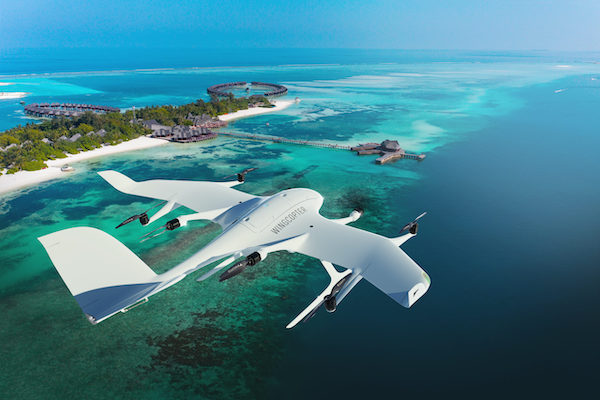
Long-range LiDAR surveys, just one pursuit of Wingcopter’s VTOL drones (vertical takeoff and landing). Image credit Wingcopter
Simulation software, AI, mesh generation, and LiDAR surveys took center stage, as exhaustively detailed in a postgame analysis by Digital Engineering 24/7. Among several behemoths highlighting accoutrements were:
Even more deets, and quotes from the C-suite, below.
Yes, yep, yeah, sure, children are the future, etc.
But did you know the future is here, now, for children? At least in Qatar, where two entire, conjoined public schools will become the globe’s King of the 3D-printed hill.And wait’ll ya hear how the digital construction masterstroke is coming to be.
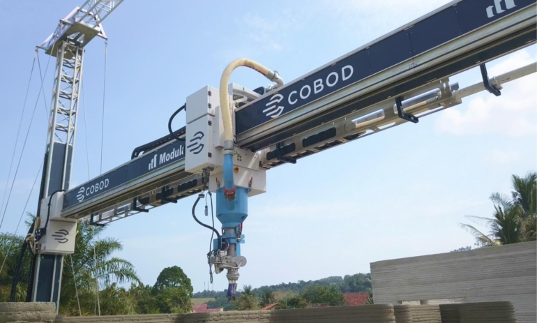
The mammoth BODXL printer, an innovators’ dream and an unknowing dental patient’s nightmare. Image credit Luxury Launches
Two colossal BODXL printers - each the size of a Boeing 737 hangar - custom-built by Danish firm COBOD and operated by UCC Holding, are fabricating the schools, which dwarf any previous 3D-printed structure by a factor of forty.
The team spent months developing specialized concrete mixtures and conducting over 100 test prints to ensure the printers could handle Qatar’s climate and deliver the complex, dune-inspired architectural forms that traditional construction could never achieve. Study up on Interesting Engineering’s blurb below, which touches on topography, night-time operations, the companies & Qatar’s Public Works Authority, raw material waste reduction, the now-second largest 3D printed structure, and more.
Y’all know reality capture can bridge people, companies, industries, even countries.
Now, it’s even bridging conservation.
The Lost Manu Research Initiative (manu = Hawaiian for “bird”) is harnessing photogrammetry and 3D scanning to tell a story of extinction & rebirth, of independence and co-evolution; all devoted to birds and plants native to Hawaii.

The Black Mamo, photogrammetried. Image credit Sam case via Hawaii Public Radio
It couldn’t come at a more opportune time, as native/invasive species, and conservation on the whole, are molten issues in the Aloha State; because as co-evolution occurs, co-extinction eventually threatens.
“If we want people to care about what’s lost, we have to show what’s beautiful, and what’s still possible,” explains Sam Case, a postdoc at the University of Washington. And by show, he means it - Lost Manu will be employing museum exhibits, public storytelling & lectures, film, and more. Reconstructed co-evolution of extinct flora and fauna, juxtaposed with contemporary species interaction, will comprise the unprecedented content.
Hawai’i Public Radio chatted up Case and Molly Hagemann, who oversees the Vertebrate Zoology Collection at Honolulu’s famed Bishop Museum. The 12 minutes explore the inspiration & vision for the project, “nectar robbing”, freakosystems, museum scanning workflows, the photogrammetry rig, public education, extinction, and why storytelling works.
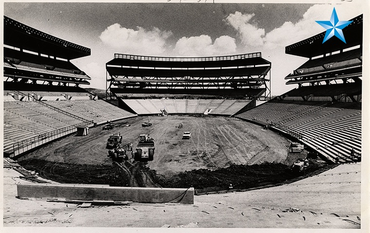
Honolulu’s Aloha Stadium had problems the world’s thickest hula skirt couldn’t cover. Image credit Honolulu Star Advertiser
Aloha Stadium in Honolulu opened in 1975 with the swagger of King Kamehameha and the promise of engineering profundity. Four movable seating sections, each weighing more than three million pounds, could slide and swivel to transform the stadium for football, baseball, or concerts. It was a shape-shifting marvel…until it wasn’t. Within a few salty Hawaiian seasons, the stadium’s greatest trick became its slow vanishing act beneath a creeping tide of corrosion.
The drama kickoff was the original design team cladding the stadium in weathering steel. On the mainland, this steel forms a protective oxide layer, like a sunburn that toughens into a tan. But in Hawaii’s ocean-kissed air, the steel just kept rusting - no protective patina, just an endless exfoliation of flakes. Instead of stabilizing, the steel corroded rapidly, earning Aloha Stadium the nickname “The Rust Palace.” By the 2010s, inspectors found “pronounced section losses,” missing bolts, and welds that had parted ways like THAT couple from The White Lotus.
Aloha Stadium’s pièce de résistance, the movable stands, quickly became an operational migraine. The air-caster system designed to float the stands across the field worked about as well as a surfboard in a lava flow. Subpar concrete pads (built thinner than specified) and relentless corrosion meant the stands could only be moved with Herculean effort - and eventually, not at all. By 2007, the feature was abandoned, leaving the stadium permanently locked in football mode. The only thing moving at Aloha Stadium after that was the rust.
Routine inspections became a horror show of cracked seats, missing hardware, and corroded beams. Emergency repairs were as frequent as rainbows, but far less uplifting. By 2020, the state threw in the towel, closing the stadium to the public and setting the stage for demolition. The stadium’s final act? A cautionary tale about what happens when you forget that Hawaii’s most abundant natural resource is saltwater.
Imagine if reality capture and digital tools had been on the guest list for Aloha Stadium’s construction luau.
Laser scanning and photogrammetry would have created a detailed digital twin of the stadium, allowing engineers to track every bolt, weld, and beam. Early warning signs of corrosion could have triggered targeted interventions before the rust went viral.
Drone inspections could have replaced risky, labor-intensive climbs, providing high-resolution images of every nook and cranny. Regular drone flyovers would have mapped the stadium’s slow decay in 3D, turning anecdotal maintenance into data-driven action.
IoT sensors embedded in the structure could have monitored humidity, salt exposure, and material degradation in real time. Alerts would have pinged maintenance crews at the first sign of trouble, not years after the fact.
BIM integration would have enabled clash detection and long-term wear tracking for the complex moving stands system, flagging the mismatch between design intent and the realities of concrete pours.
Aloha Stadium was built to be everything for everyone, but it forgot to be anything for the climate it called home. In the end, the only thing that moved reliably was the rust - relentless, undefeated, and immune to good intentions. Today’s reality capture and digital tools can’t change the past, but they can ensure that the next stadium built in paradise won’t be a monument to maintenance regret. In Hawaii, as in construction, you can’t outsmart the ocean - but you can at least see it coming, in high definition, before it eats your stadium for lunch.


By subscribing, you are agreeing to RCN’s Terms and Conditions of Use. To learn how RCN collects, uses, shares, and protects your personal data, please see RCN’s Privacy Policy.
Reality Capture Network • Copyright 2025 • All rights reserved


